 Learn with me publication
LOCATION
- Books Name
- Learn with me Social Science Book
- Publication
- Learn with me publication
- Course
- CBSE Class 9
- Subject
- Social Science
INDIA — SIZE AND LOCATION
India is an ancient civilisation but now it is a developing nation. It has shown remarkable progress in various fields.
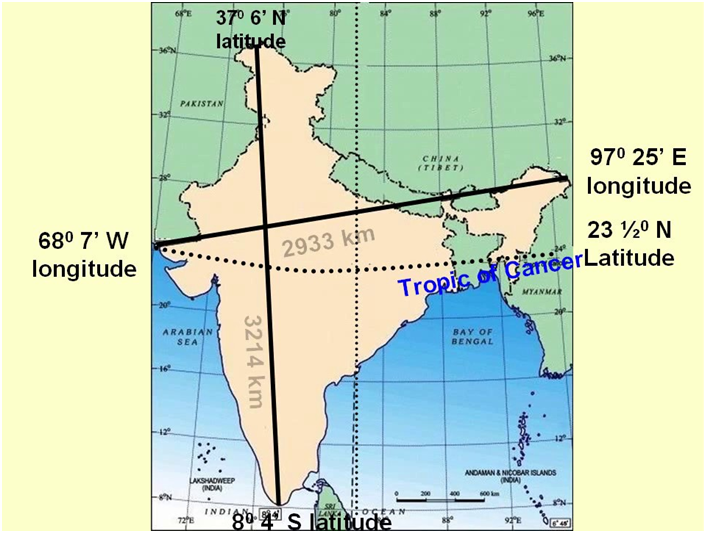
Location
- India lies entirely in the Northern Hemisphere.
- India’s mainland extends between
 latitudes, and
  longitudes.
 - The Tropic of Cancer
 divides India into two almost equal parts.
 - The island groups of Lakshadweep and Andman & Nicobar are also part of India.
Size
- Covering an area of 3.28 million square kilometres, India’s total area is 2.4% of the total geographical area of the world.
- India is the world’s seventh largest country with a land boundary of about 15,200 km, with total length of the coastline being 7,516.6 km.
- India’s east-west extent appears to be smaller than the north-south extent.
- India’s latitudinal and longitudinal extent is about 30 degrees.
- India’s standard time is based on 82.30 degrees E meridian, which passes near Mirzapur in UP.
- Latitudinal extent influences duration of the day and night.
India and the World
- The Indian landmass is centrally located between West and East Asia.
- The trans Indian ocean routes connect countries in the west and counties in the east.
- India’s protruding Deccan Peninsula helped India to establish close contacts with West Asia, Africa and Europe, South-east and East Asia.
- India’s contacts with the world via land routes are much more than her maritime contacts.
- India is the only nation which has a ocean named after it.
- India has contributed a lot to the world in forms of ideas, philosophies (Upanishads, Ramayana, Panchtantra) and mathematics (Indian numerals and decimal system).
- In exchange, India’s architecture was influenced by Greek sculpture and architectural styles from West Asia.
INDIA’S NEIGHBOURS
- Books Name
- Learn with me Social Science Book
- Publication
- Learn with me publication
- Course
- CBSE Class 9
- Subject
- Social Science
India’s Neighbours
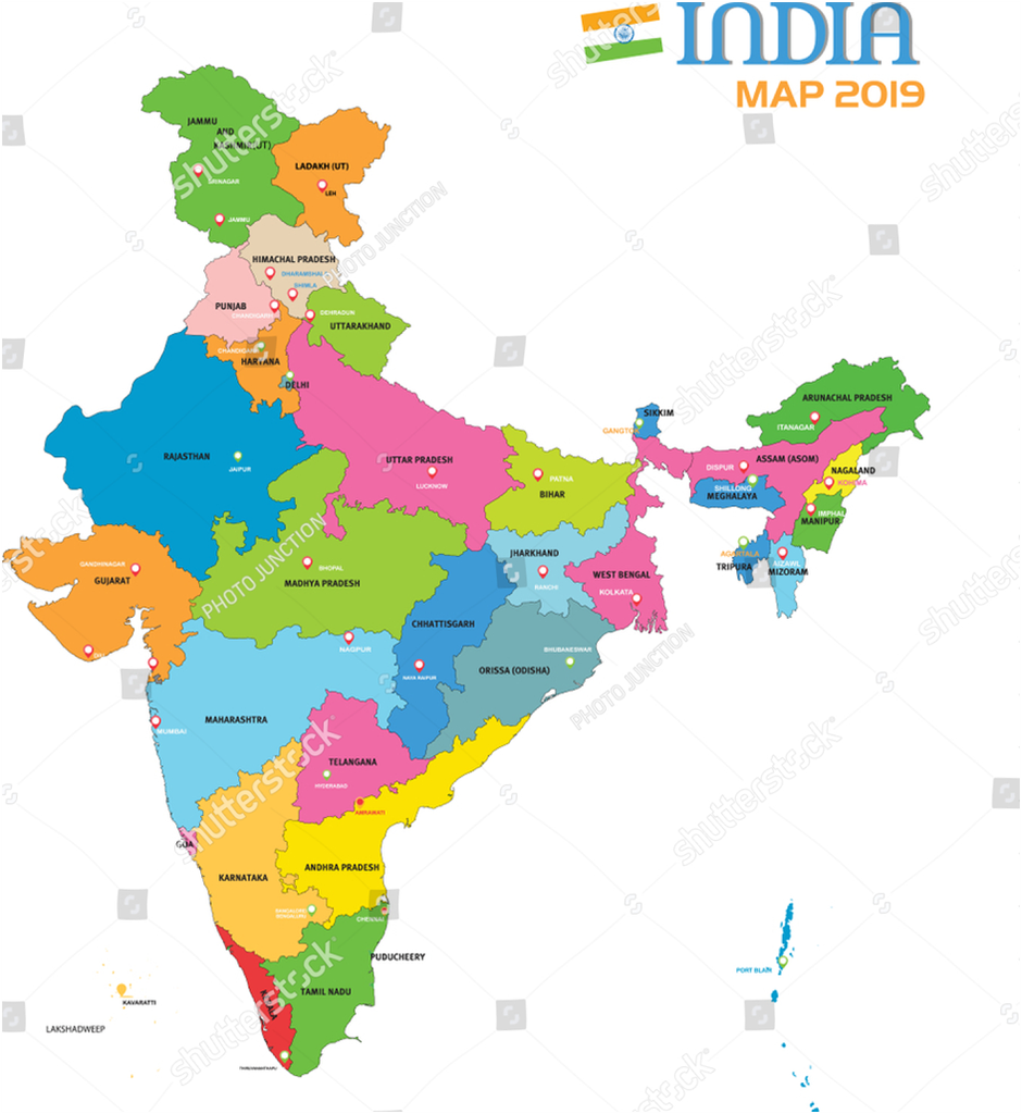
- India has an important position in South Asia and has 29 States and 7 Union Territories.
- India shares its boundaries with Pakistan, Afghanistan, China, Nepal, Bangladesh, Myanmar and Bhutan.
- The southern neighbours across the sea consist of the two island countries, namely Maldives and Sri Lanka.
- Shri Lanka is separated from India by Pak Strait, a narrow strip of sea.
- India always have and had strong geographical and historical links with her neighbours.
- India stands apart from the rest of Asia.
MAJOR PHYSIOGRAPHIC DIVISIONS
- Books Name
- Learn with me Social Science Book
- Publication
- Learn with me publication
- Course
- CBSE Class 9
- Subject
- Social Science
Physical Features of India
Location
- India has all major physical features of the Earth, i.e. mountains, plains, deserts, plateaus and islands.
- In India the soil colour varies from place to place as it is formed from different types of rocks.
- India is a large landmass formed during different geological periods.
- India’s relief features are outcome of other processes like weathering, erosion and deposition.
- India has varied physical features whose formation can be explained on the basis of the ‘Theory of Plate Tectonics’.
- According to the theory of Plate Tectonics the seven major and minor plates that form the Earth’s crust keep moving, causing stress and thus leading to folding, faulting and volcanic activity.
- Plates can have convergent, divergent and transform boundaries.
- India’s peninsular part is made from one of the oldest landmass of the world ‘Gondwana land’. It was a single landmass comprising of India, Australia, South Africa, South America and Antarctica.
- The physical features of India can be grouped under the following physiographic divisions :
(i) The Himalayan Mountains.
(ii) The Northern Plains
(iii) The Peninsular Plateau
(iv) The Indian Desert
(v) The Coastal Plains
(vi) The Islands
The Himalayan Mountains
- The Himalayas are young-fold mountains which are the loftiest and one of the most rugged mountain barriers of the world.
- The Himalayas are 2400 km long, 400 km to 150 km wide from Kashmir to Arunachal Pradesh respectively.
- The Himalayas have three parallel ranges in the longitudinal extent namely :
— Great or Inner Himalayas also called Himadri. It is the highest mountain range with average height 6000 m.
— Middle Himalayas or Himachal. The altitude varies between 3700 and 4500 m. It includes ranges like Pir Panjal, Dhaula Dhar and Mahabharat.
— Outer Himalayas or Shivalik. It is outermost range with 900 to 1100 m average altitude.
The longitudinal valley lying between and lesser Himalaya and Shiwaliks are known as Duns.
- The Himalayas can be divided into four sections :
— Punjab Himalayas — between Indus and Satluj.
— Kumaon Himalayas — between Satluj and Kali.
— Nepal Himalayas — between Kali and the Tista.
— Assam Himalayas (Eastern Himalayas) — Between Tista and the Dibang (Tsangpo).
The Northern Plains
- It is formed by the interplay of the three major river systems – the Indus, the Ganga and the Brahmaputra.
- The Northern Plains spread over an area of 7 lakh sq. km, 240 km long and 240 km to 320 km broad.
- The rivers that flow to the plains from the mountains are involved in depositional work.
- Difference in relief causes the Northern Plain to have four regions.
— Bhabar — laying at the foot of Shiwaliks, a narrow 8 to 16 km wide belt of pebbles.
—Terai — lying next to Bhabar, a wet and marshy area with wildlife and forests.
—Bangar — Older alluvium plain which rises above the level of the flood plains.
— Khadar — Younger alluvium of the flood plains.
The Peninsular Plateau
- The Peninsular Plateau is the tableland formed due to the breaking and drifting of the Gondwana land.
- It is composed of the old crystalline, igneous and metamorphic rocks.
- The plateau consists of two broad divisions, namely, the Central Highlands and the Deccan Plateau.
- Central highlands lie north to river Narmada.
- The eastward extensions of Peninsular Plateau are locally known as Bundelkhand and Baghelkhand. The Chhota Nagpur Plateau marks the further eastward extension drained by the Damodar river.
- The Deccan Plateau, a triangular mass, lies to the south of the river Narmada.
- The western and eastern edges of the Deccan Plateau are marked by the Western Ghats and the Eastern Ghats respectively.
- The Western Ghats are higher than the Eastern Ghats.
- Anaimudi is the highest peak in Western Ghats ( 2695 m ) and Mahendragiri with 1501 m. is the highest peak in Eastern Ghats.
- A distinct feature of the peninsular plateau is the black soil area known as Deccan Trap.
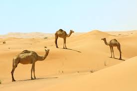
The Indian Desert
- The undulating sandy plain covered with sand dunes towards the western margins of the Aravalli Hills is the Indian Desert.
- Crescent shaped dunes called barchans cover large parts of the Indian Desert.
- It has a very less rainfall around 150 mm.
- Luni is the only large river in this region.
The Coastal Plains
- The narrow coastal strips flank the Peninsular Plateau.
- On the west the coastal strips are divided into Konkan (Mumbai-Goa), Kannad Plain and the Malabar coast from northern to southern part.
- The plains along the Bay of Bengal are wide and level.
- On the east the coastal strip is divided into Northern Circars and the Coromandal Coast from northern to southern part.
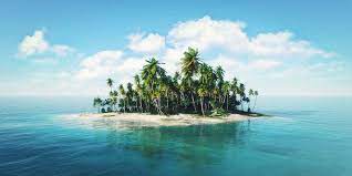
The Islands
- The Lakshadweep Islands group in the Arabian Sea is close to Kerala.
- The Lakshadweep Islands were formerly known as Laccadive, Minicoy and Amindive.
- The Andaman and Nicobar Islands are an elongated chain of islands located in the Bay of Bengal.
- The Andaman and Nicobar Islands are an elevated portion of submarine mountains.
The regions in India complements each other and makes the country richer in its natural resources. Mountains are the source of forests and water. Plains provide grains. Plateaus are storehouses of minerals. Coastal areas support fishing and ports.
DRAINAGE SYSTEMS IN INDIA
- Books Name
- Learn with me Social Science Book
- Publication
- Learn with me publication
- Course
- CBSE Class 9
- Subject
- Social Science
Drainage
- ‘Drainage’ is a term which describes the river system of an area.
- A drainage basin or river basin is an area which is drained by a single river system.
- An upland that separates two drainage systems that are next to each other is called a water divide.
- On the basis of origin, there are two river systems of India — The Himalayan rivers and the Peninsular rivers.
- Himalayan rivers are rainfed and snowfed, so they have water in them throughout the year, i.e. they are perennial.
- Himalayan rivers perform intensive erosional activity in the upper course.
- In the lower course, they carry huge loads of silt and sand.
- Himalayan rivers create meanders, oxbow lakes and other depositional features on their course.
- Peninsular rivers are seasonal; mostly depending on rainfall.
- Most of the rivers of peninsular India originate in the Western Ghats and flow towards the Bay of Bengal.
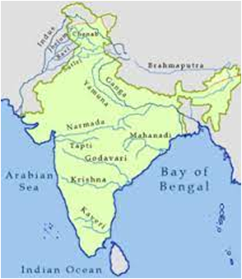
The Himalayan Rivers
- A river along with its tributaries may be called a river system.
- The major Himalayan rivers are the Indus, the Ganga, and the Brahmaputra.
The Narmada Basin
- Rising in the Amarkantak hills, Narmada flows to create a gorge in marble rocks of Madhya Pradesh.
- Narmada flows towards the west in a rift valley formed due to faulting.
- Near Jabalpur it flows in the form of deep gorge in the marble rocks and Dhuadhar falls are picturesque locations.
The Tapi Basin
- Originating in Betul, Madhya Pradesh in Satpura ranges.,
- It also flows in a rift valley parallel to the Narmada but is much shorter than Narmada.
- Tapi flows through a basin that covers Madhya Pradesh, Gujarat and Maharashtra.
The main west flowing rivers are Sabarmati, Mahi, Bharathpuzha and Periyar.
The Godavari Basin
- Godavari begins in Nasik district of Maharashtra and is the largest peninsular river about 1500 km.
- Its large basin covers most parts of Maharashtra, Madhya Pradesh, Orissa and Andhra Pradesh.
- The tributaries which join the Godavari include Purna, Wardha, Pranhita, Manjra, Wainganga and Penganga.
- Because of its length and the area it covers, Godavari is also known as the Dakshin Ganga.
- Godavari drains into the Bay of Bengal.
The Mahanadi Basin
- The Mahanadi, a 860 km long river, rises in Chhattisgarh to flow through Orissa to reach the Bay of Bengal.
- Mahanadi river basin is shared by Maharashtra, Orissa, Jharkhand and Chhattisgarh.
The Krishna Basin
- The 1400 km long Krishna river rises from a spring near Mahabaleshwar to reach the Bay of Bengal.
- The tributaries of Krishna include Bhima, Musi, Ghatprabha, Koyana and Tungabhadra. The Krishna basin is shared by Maharashtra, Karnataka and Andhra Pradesh.
The Kaveri Basin
Originating in the Brahmagiri range of the Western Ghats, the Kaveri reaches the Bay of Bengal at Kaveripatnam, sharing its basin with Karnataka, Tamil Nadu and Kerala.
The river Kaveri makes second biggest waterfall in India known as Sivasamudram.
Other smaller rivers like Damodar, Brahmani, the Baitarani and Subarnlekha
RIVER SYSTEM
- Books Name
- Learn with me Social Science Book
- Publication
- Learn with me publication
- Course
- CBSE Class 9
- Subject
- Social Science
The Indus River System
• Rising near Lake Mansarovar in Tibet, the Indus enters India in the Ladakh district of Jammu and Kashmir.
• Zaskar, the Nubra, the Shyok are the tributaries in Kashmir.
• Rivers Satluj, Beas, Ravi, Chenab and Jhelum join Indus near Mithankot, Pakistan and flow southwards to fall into the Arabian Sea, east of Karachi.
• With a total length of 2900 km, the Indus is one of the longest rivers of the world.
• India and Pakistan have distributed Indus river water according to Indus Water Treaty in 1960.
The Ganga River System
• The headwaters of the Ganga are called ‘Bhagirathi’ is fed by the Gangotri Glacier and joined by the Alaknanda at Devprayag in Uttarakhand.
• Ganga meets the tributaries from the Himalayas such as Ghaghara, Gandak and Kosi.
• A major river Yamuna, arising from Yamunotri Glacier in the Himalayas, joins Ganga at Allahabad.
• Other tributaries — Chambal, Betwa and Son — come from Peninsular uplands to join Ganga.
• Farukka in West Bengal is the northernmost point of the Ganga Delta.
• Ganga is joined by Brahmaputra and forms river Meghna which flows through Bangladesh to reach the Bay of Bengal.
• The delta formed when the Ganga and the Brahmaputra flow into the Bay of Bengal is known as the Sunderban Delta.
• The length of the Ganga is over 2500 km and it develops large meanders in the downstream plain areas.
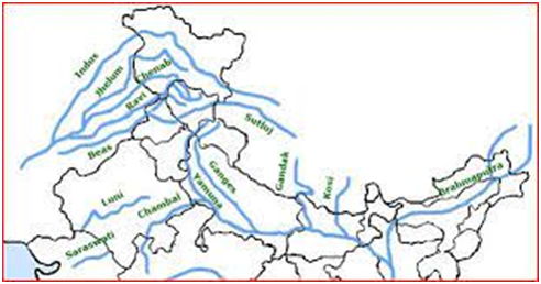
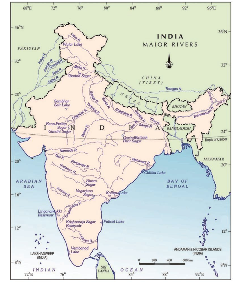
The Brahmaputra River System
• Originating in Tibet, very close to the sources of Indus and Satluj, Most of its course lies outside the India.
• On reaching Namcha Barwa it takes a ‘U’ turn and enters in Arunachal Pradesh to flow to Assam joined by many tributaries.
• The tributaries that join Brahmaputra are Dibang, Lohit, and Kenula.
• The Brahmaputra has a braided channel in its entire length in Assam to form many riverine islands. World’s largest riverine island is found in Brahmaputra.
• Unlike other north Indian rivers, the Brahmaputra is marked by huge deposits of silt on its bed, causing the riverbed to rise.
The Peninsular Rivers
• Western Ghats form the main water divide in peninsular India.
• The major rivers of the peninsula — Mahanadi, Godavari, Krishna and Kaveri — flow eastwards to drain into the Bay of Bengal.
• The Tapi and Narmada are the only rivers which flow west to make estuaries and drain into the Arabian Sea.
• The drainage basins of the peninsular rivers are comparatively small in size.
Lakes
• Most lakes are permanent while other contain water only during the rainy season.
• Some lakes are result of the glacial action and ice sheets and some may have been formed by wind, river action and human activities.
• A river meandering across a floodplain forms cut-offs that later develop into oxbow lakes.
• Glacial lakes are formed when glaciers dig out a basin which is later filled with snowmelt.
• Some lakes like Wular Lake in Jammu and Kashmir result from tectonic activity.
ROLE OF RIVERS IN THE ECONOMY
- Books Name
- Learn with me Social Science Book
- Publication
- Learn with me publication
- Course
- CBSE Class 9
- Subject
- Social Science
Role of rivers in the economy
- Rivers are natural sources of water.
- Settlements on the river banks have developed into cities.
- Rivers are used for irrigation, navigation, hydro-power generation, all vital for India, an agricultural economy.
River Pollution
- Quality of river water is affected by the growing domestic, municipal, industrial and agricultural demand.
- A heavy load of untreated sewage and industrial effluents are emptied into the river affecting the river’s self-cleaning property.
- Concern over rising pollution in our rivers led to the launching of various action plans to clean the rivers.
CLIMATE
- Books Name
- Learn with me Social Science Book
- Publication
- Learn with me publication
- Course
- CBSE Class 9
- Subject
- Social Science
CLIMATE
- General weather conditions over a period of thirty years period is said to be the climate of a place.
- Weather refers to the state of the atmosphere over an area at any point of time.
- Temperature, atmospheric pressure, wind, humidity, and precipitation are elements of weather and climate.
- Generalised monthly atmospheric conditions determine the basis on which the year is divided into the seasons — summer, winter or rainy.
- India has a monsoon type of climate.
- Monsoon is basically a seasonal reversal in the wind through the year.
- There is huge difference in temperature from one region to another.
- Form of precipitation, its amount and distribution also differ from one part of India to another.
- Coastal areas observe lesser difference in temperature conditions. It is the interior of India that experiences temperature contrasts.
- Decrease in rainfall is seen from east to west in the Northern Plains. All this influences diversity in professions, food, dress and houses of people.
Climatic Controls
- The interplay of latitude, altitude, distance from the sea, pressure and wind system, ocean currents and relief features determine climatic conditions of a place.
FACTORS AFFECTING INDIA’S CLIMATE
- Books Name
- Learn with me Social Science Book
- Publication
- Learn with me publication
- Course
- CBSE Class 9
- Subject
- Social Science
Factors Affecting India’s Climate
- Latitude, altitude and pressure and winds affect Indian climate.
- The Tropic of Cancer passes through the middle of the country from the Rann of Kuchchh to Mizoram.
- Air temperature generally decreases from equator to poles.
- Temperature and air pressure decreases as on moves from surface of the earth to higher altitudes.
- The Himalayas prevent the cold winds from central Asia from entering the subcontinent.
- The climate and associated weather conditions in India are governed by various atmospheric conditions namely pressure and surface winds, upper air circulation, western cyclonic disturbances and tropical cyclones.
- The sea exerts a moderating influence on climate. People far away from sea experience extreme weather conditions. This is known as ‘continentality’.
- Ocean currents also affect the climate of the coastal areas.
- An apparent force caused by the earth’s rotation is the Coriolis Force.
- The wind direction changes as per the season. They are from northeast to south wet in winter whereas completely reverse in summer bringing moisture.
- Jet streams are narrow belts of high-altitude (above 12,000 m) westerly winds in the troposphere.
- The western cyclonic disturbances are weather phenomena of the winter months, brought in by the westerly flow from the Mediterranean region.
THE INDIAN MONSOON
- Books Name
- Learn with me Social Science Book
- Publication
- Learn with me publication
- Course
- CBSE Class 9
- Subject
- Social Science
The Indian Monsoon
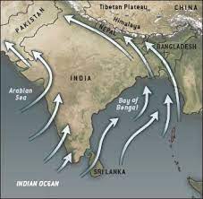
- The climate of India is strongly influenced by monsoon winds.
- The Arab traders who noticed these winds named it as monsoon.
Following facts are important to understand mechanism monsoons –
- The differential heating and cooling of land and water.
- The Inter-Tropical Convergence Zone (ITCZ) is a broad trough of low pressure in equatorial latitudes where the northeast and the southeast trade winds converge.
- The presence of the high-pressure area, east of Madagascar.
- The intense heating of Tibetan plateau during summer.
- The movement of the westerly jet stream to the north of the Himalayas and the presence of the tropical easterly jet stream over the Indian peninsula during summer.
- Apart from his changes in the pressure conditions over the southern oceans also affect monsoon.
- The periodic change in pressure conditions known as ‘Southern Oscillation’ or SO affects monsoon too.
- El Nino is a warm ocean current that flows past the Peruvian coast in place of the cold Peruvian current, every 2 to 5 years.
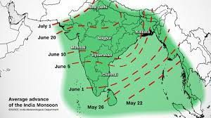
The Onset of the Monsoon and Withdrawal
- The monsoon are pulsating winds affected by different atmospheric conditions encountered by it, on its way over the warm tropical seas.
- Monsoon arrives at the southern tip of the Indian peninsula generally by first week of June.
- Sudden increase and continuation of the monsoon for several days is called as ‘burst’.
- The Arabian Sea and the Bay of Bengal branches of the monsoon merge over the northwestern part of the Ganga plains.
- The withdrawal or the retreat of the monsoon is a more gradual process which begins in the northwestern states of India by early September.
- The retreating monsoon or the transition season sees the change from hot rainy season to dry winter conditions.
- The low-pressure conditions over northwestern India get transferred to the Bay of Bengal by early November causing cyclonic depressions originating over the Andaman Sea.
THE SEASONS
- Books Name
- Learn with me Social Science Book
- Publication
- Learn with me publication
- Course
- CBSE Class 9
- Subject
- Social Science
Distribution of Rainfall
- Owing to the nature of monsoons, the annual rainfall is highly variable from year to year.
- Areas of high rainfall are liable to be affected by floods while areas of low rainfall are drought prone.
The Seasons
- Four main seasons can be identified in India — the cold weather season, the hot weather season, the advancing monsoon and the retreating monsoon with some regional variations.
- In the cold weather season the northeast trade winds prevail over India.
- Days are warm and nights are cold.
- Frost is common in the north and the higher slopes of the Himalayas experience snowfall.
- The summer months experience rising temperature and falling air pressure in the northern parts of the country.
- A striking feature of the hot weather season are strong, gusty, hot, dry winds blowing during the day over the north and northwestern India called loo.
- In the advancing monsoon, i.e. the rainy season, the north-western region of the country receives the maximum rainfall.
- The dust storms in northern India are common.
- The localised thunderstorms, associated with violent winds, torrential downpours, often accompanied by hail. In west Bengal they are known as ‘Kaal Baisakhi’.
- From June onwards the monsoon occupies most of the Indian Peninsula and central part within a month.
- Monsoon has ‘breaks’ in rainfall, thus it has wet and dry spells.
- The alternation of dry and wet spells vary in intensity, frequency and duration causing heavy floods in one part and droughts in the others.
- By the beginning of October the monsoon withdraws from Northern plains.
- The conditions of high temperature and humidity, the weather becomes rather oppressive during the day and is called as October heat.
- Rainfall in India ranges from 400 cm in western coast and northeastern India to 60 cm in Western Rajasthan and adjoining area.
Monsoon as a Unifying Bond
- The dependence of farmers on rain, a change in seasonal cycle, variance in temperature, the needs of humans, plants and animals, festival dates etc., all depend on monsoon in India. In this way monsoon is a unifying bond for Indians.
RELIEF
- Books Name
- Learn with me Social Science Book
- Publication
- Learn with me publication
- Course
- CBSE Class 9
- Subject
- Social Science
Natural Vegetation and Wild Life
- With over 47,000 plant species, India occupies tenth place in the world and fourth in Asia in plant diversity. It includes 15000 or 6% of the world’s total flowering plants.
- India is one of the twelve mega biodiversity countries of the world.
- India has 89,000 species of animals as well as a rich variety of fish in its fresh and marine waters.
- Plant community which grows naturally with no human help and is not disturbed by humans for a long time is teemed as natural vegetation.
- The term flora denotes plants and fauna denotes species of animals in a specific region.
- The natural vegetation which has been left undisturbed by humans for a long time is called virgin vegetation.
- Virgin vegetation which are purely Indian are known as endemic species and those which have come from outside India are termed as exotic plants.
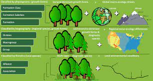
Factors determining flora and fauna in a region are as follows.
Relief
- The nature of land influences the type of vegetation. It includes mountains, plains and plateaus as well as dry and wet regions.
- Different types of soils provide basis for different types of vegetation. The sandy, deltaic and other types soils support different types of vegetations.
Climate
- Temperature, photoperiod, and precipitation are the three climatic factors which determine natural vegetation.
- The character and extent of vegetation are mainly determined by temperature along with humidity in the air, precipitation, and soil. As per temperature, the vegetation types differ from tropical to subtropical and alpine.
- Period of exposure to sunlight varies for different plants leading to their different rates of growth. Due to longer duration of sunlight trees grow faster in the summer.
- Areas of heavy rainfall have more dense vegetation as compared to other areas of less rainfall.
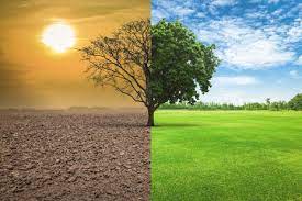
- Forests are renewable resources and play a major role in enhancing the quality of the environment. They modify local climate, control soil erosion, regulate stream flow, provide livelihood for many communities.
- It controls wind force and temperature and causes rainfall.
- Vegetation in most parts of India has been modified at some places or replaced or degraded by human occupancy.
Ecosystem
- All the plants and animals in an area are interdependent and interrelated to each other in their physical environment, thus forming an ecosystem.
- Human beings are integral part of ecosystem.
- The greed of human beings leads to overutilisation of resources.
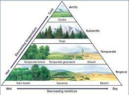
- A very large ecosystem on land having distinct type of vegetation and animal life is called a biome.
TYPES OF VEGETATION
- Books Name
- Learn with me Social Science Book
- Publication
- Learn with me publication
- Course
- CBSE Class 9
- Subject
- Social Science
Types of Vegetation
- The major types of vegetation in India are Tropical Rainforests, Tropical Deciduous Forests, Tropical Thorn Forests and Scrubs, Montane Forests and Mangrove Forests.
- With warm and wet climate all year round the Tropical Rainforests have luxurious trees, shrubs and creepers. The rainfall is more than 200 cm.
- The are restricted to heavy rainfall areas of the Western Ghats and Island groups, upper parts of Assam and Tamilnadu.
- A large variety of animals are found in the rainforests.
- The most widespread forests of India — the Tropical Deciduous Forests — are also known as the Monsoon Forests. Rainfall ranges between 200 to 70 cm.
- On the basis of the availability of water, these forests are further divided into moist and dry deciduous forests.
- These are spread across northeastern states, foothills of Himalayas, Jharkhand, West Orissa, and Chhattisgarh and eastern slopes of Western Ghats.
- Lions, tiger, pig, deer elephant, variety of birds, reptiles are found here.
- The leaves of vegetation in Thorn Forests and Scrubs are mostly thick and small to minimize evaporation and have succulent stems to conserve water. Rainfall is less than 70 cm.
- These forests are found in Northwestern part of the country and semi-arid areas of Gujrat, Rajasthan, M.P. Chhattisgarh, U.P., and Haryana.
- Common animals found are rats, mice, rabbits, fox, wolf, tiger, lion etc.
- Montane forests have a succession of natural vegetation belts in the same order as we see from the tropical to the Tundra region.
- Wet temperate forests are found between a height of 1000 and 2000 meters while temperate grasslands are found at higher elevations above 3600 meters and give way to alpine vegetation.
- At 3600 meters above sea level, temperate forests and grasslands give way to alpine vegetation.
- The mangrove tidal forests are found in the areas of coasts influenced by tides.
- Dense mangroves are the common varieties with roots of the plants submerged underwater.
- Delta regions of major rivers have such vegetation.
- Royal Bengal Tiger is famous animal of these forests.
- India has more than 1200 species of birds, 2500 species of fish and between 5 to 8 percent of the world’s amphibians, reptiles, and mammals.
- India is the only country in the world that has both tigers and lions.
- The Himalayas have a large range of animals that survive the bitter cold.
- Every species of animal has a role to play in the ecosystem; hence conservation is essential.
- Hunting and pollution is causing threat to animal species.
- To protect the flora and fauna of the country, the government has taken many steps.
- Fourteen biosphere reserves have been set up in the country to protect flora and fauna.
- 89 National Parks, 49 Wildlife Sanctuaries and Biosphere Reserves have been set up to take care of natural heritage
POPULATION GROWTH, SIZE AND DISTRIBUTION
- Books Name
- Learn with me Social Science Book
- Publication
- Learn with me publication
- Course
- CBSE Class 9
- Subject
- Social Science
POPULATION SIZE AND DISTRIBUTION
• People are themselves resources with varying qualities.
• Population is the point of reference from which all other elements are observed and from which they derive significance and meaning like resources, calamities, disasters etc.
• The Census of India provides us with information regarding the population of our country.
• Census is an official enumeration of population done periodically. In India census is held every 10th year.
• Uttar Pradesh accounts for about 16 per cent of the country’s population.
• India’s population as in March 2001 stood at 1,028 million accounting for 16.7 per cent of the world’s population.
• Almost half of the India’s population lives in just five states. These are Uttar Pradesh, Maharashtra, Bihar, West Bengal and Andhra Pradesh.
• Population density is calculated as the number of persons per unit area.
• Population density is affected by relief of the area.
Population Growth
• The numbers, distribution and composition of the population are constantly changing. Hence population is a dynamic phenomenon.
• Growth of population refers to the change in the number of inhabitants of a country/territory during a specific period of time.
• Since 1982 India’s population growth rate is on the decline.
• When more than a billion people increase even at lower rate, the total numbers added becomes very large.
• The declining trend of the growth rate is indeed a positive indicator of the efforts of birth control.
• The natural increase of population is the difference between birth rates and death rates.
• The number of deaths per thousand persons in a year is the Death Rate.
• Migration is the movement of people across regions and territories.
• Migration can be internal and international.
• Migration changes not only population size but also the population composition of urban and rural populations in terms of age and sex composition.
• Pull and push are the factors responsible for migration.
POPULATION GROWTH
- Books Name
- Learn with me Social Science Book
- Publication
- Learn with me publication
- Course
- CBSE Class 9
- Subject
- Social Science
Population Growth and Processes of Population Change
- The numbers, distribution and composition of the population are constantly changing. Hence population is a dynamic phenomenon.
- Growth of population refers to the change in the number of inhabitants of a country/territory during a specific period of time.
- Since 1982 India’s population growth rate is on the decline.
- When more than a billion people increase even at lower rate, the total numbers added becomes very large.
- The declining trend of the growth rate is indeed a positive indicator of the efforts of birth control.
- The natural increase of population is the difference between birth rates and death rates.
- The number of death per thousand persons in a year is the Death Rate.
- Migration is the movement of people across regions and territories.
- Migration can be internal and international.
- Migration changes not only population size but also the population composition of urban and rural populations in terms of age and sex composition.
- Pull and push are the factors responsible for migration.
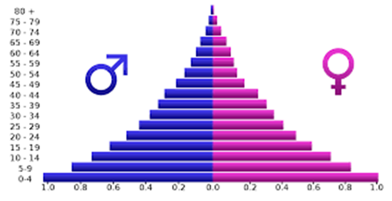
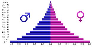
- The age composition of a population refers to the number of people in different age groups in a country.
- The population of a nation is generally grouped into three broad categories, namely children (generally below 15 years), working age (15 – 59) years) and aged (above 59 years).
- Sex ratio is defined as the number of females per thousand males in the population.
- The sex ratio in India has always remained unfavorable to females.
- Keral has the highest sex ratio whereas Delhi and Haryana are amongst lowest.
- A person of seven years of age or above who is able to read and write with a certain understanding is called a literate.
- Males have more literacy than females.
- The distribution of the population according to different types of occupation is referred to as the occupational structure.
- Primary activities include agriculture, animal husbandry, forestry, fishing, mining and quarrying etc. Secondary activities include manufacturing industry, building and construction work etc. Tertiary activities include transport, communications, commerce, administration and other services.
- Sustained efforts of government programmes have registered significant improvements in the health conditions of the Indian population. Death rate is considerably reduced.
- It is a matter of concern that the per capita calorie consumption is much below the recommended level in India.
- Adolescent population constitutes one fifth of the total population of India.
- Adolescents in India face the problem of malnutrition that can be dealt with by spreading awareness, literacy and education among them.
- The Family Welfare Programme has sought to promote responsible and planned parenthood on a voluntary basis.
National Population Policy 2000 aims at improving conditions of adolescents, aiming at encourages delayed marriages and child bearing, educating about risks of unprotected sex and provisions for nutritional needs
Processes of Population Change/Growth
- Books Name
- Learn with me Social Science Book
- Publication
- Learn with me publication
- Course
- CBSE Class 9
- Subject
- Social Science
Population Growth and Processes of Population Change
Due to births, deaths and migrations the number, distribution and composition of population change continuously.
Population Growth
The change in the number of people of a country or state during a specific period of time is called growth of population. Usually, it is mostly calculated at the interval of 10 years. The change can be expressed either in terms of absolute numbers or in terms of annual growth rate.
Absolute Increase of Population It means the absolute numbers added each year or in each decade in the population. It is obtained by simply subtracting the earlier population (e.g., that of 1991) from the later population (e.g., that of 2001).
Annual Growth Rate of Population The rate at which the number of individuals in a population increase in 1 year as a fraction of the initial population; is called annual growth rate of population. It is expressed in terms of per cent per annum. For example, a rate of increase of 2% per annum means that there was an increase of 2 persons for every 100 persons in the initial population.
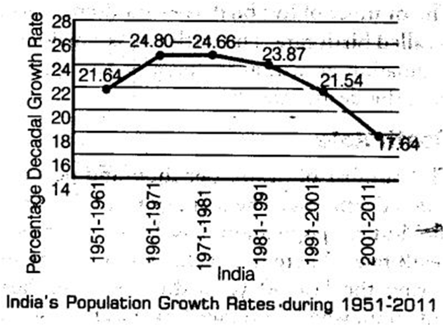
Population Growth Rate Since Independence
India’s annual growth rate of population increased steadily till 1981. Since then, the annual rate of population growth started declining. Still the population growth of India in 1990s was 182 million (in terms of number). This addition of people was larger than ever before. In spite of decreasing annual growth rate (in percent), the largest addition in people (in terms of number) is due to the large population of the country.
Occupational Structure
- Books Name
- Learn with me Social Science Book
- Publication
- Learn with me publication
- Course
- CBSE Class 9
- Subject
- Social Science
Occupational Structure
Occupational structure referred to as the distribution population according to various types of occupation.
Economically active population percentage is an important index of development. There is a large variety of occupation in the country. The occupations are usually categorized into
• Primary
• secondary
• tertiary occupations.
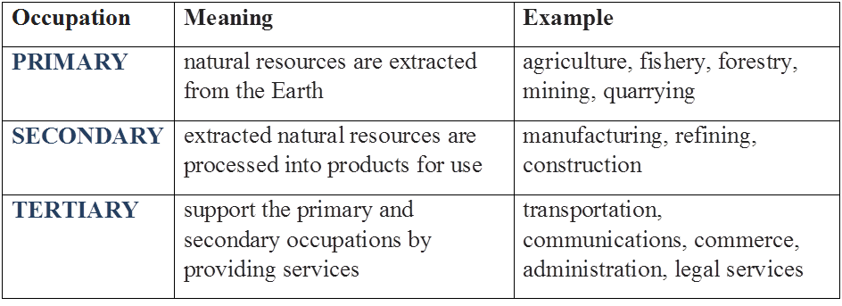
Primary occupations are those in which natural resources are extracted from the Earth. These include agriculture, fishery, forestry, mining, quarrying, etc.
Secondary occupations are those in which the extracted natural resources are processed into products for use. These include manufacturing, refining, construction, etc.
Tertiary occupations are those which support the primary and secondary occupations by providing services. This transportation, communications, commerce, administration, legal services, etc.
The pattern of the Working Population
The proportion of people working in different activities vary in developed and developing countries. The developing countries have more of their population working in primary occupations, whereas the developed nations have more of their population working in secondary and tertiary occupations.
In India, half of the population is engaged in agriculture alone. However, due to industrialisation and urbanisation in recent times, there has occurred a significant shift towards secondary and tertiary occupations which earlier stood about 13% and 20%, respectively.
Health
Health is an important component of population composition. It affects its development significantly. Due to the sustained efforts of government, healthcare programmes, life expectancy at birth has improved from 36.7 years in 1951 to 64.7 years in 2011.
The death rate has declined from 25 per 1000 persons in 1951 to 7.2 in 2011. However, healthcare and nutrition are still major issues. Malnutrition in children afflicts a large percentage of the population.
Availability of safe drinking -water and proper sanitation are major problems in rural areas and need urgent action. Only one-third of the rural population has these basic amenities. The level of nutrition and per capital calorie consumption is much below the recommended level. This can be reduced by appropriate policy on population.
Adolescent Population
Adolescents are population aged from 10 to 19 years. They currently comprise about 20% of India’s population and are an important future resource for the country.
Their nutritional requirements are more than that of either adults or younger children, but it our country the diet available for them is usually inadequate for their requirements, which leads to deficiency and stunted growth. Many adolescent girls suffer from anaemia and they must be made aware of their requirements through better education and literacy they confront.
National Population Policy
Government of India initiated its first Family Planning Programme in 1952. This, promoted responsible and planned parenthood on a voluntary basis. In the year 2000, the government formulated the National Population Policy (NPP 2000), which had the following major objectives
• Providing a policy framework for imparting free and compulsory school education up to 14 years of age.
• Reducing infant mortality rate to below 30 per 1000 live births.
• Achieving universal immunization of children against all vaccine-preventable diseases.
• Promoting delayed marriage for girls.
• Making family welfare a people-centred programme.
NPP 2000 and Adolescents
National Population Policy (NPP) 2000 identified adolescents as one of the major sections of the population that need greater attention.
NPP 2000 put greater emphasis on the important needs of adolescents including protection from unwanted pregnancies,’ Sexually Transmitted Diseases (STDs) and risks of unprotected sex. It focussed on programmes that aim towards encouraging delayed marriage and childbearing, education of adolescents, providing food supplements and nutritional services, etc.
Summary points
• The age composition of a population refers to the number of people in different age groups in a country.
• The population of a nation is generally grouped into three broad categories, namely children (generally below 15 years), working age (15 – 59) years) and aged (above 59 years).
• Sex ratio is defined as the number of females per thousand males in the population.
• The sex ratio in India has always remained unfavourable to females.
• Kerala has the highest sex ratio whereas Delhi and Haryana are amongst lowest.
• A person of seven years of age or above who is able to read and write with a certain understanding is called a literate.
• Males have more literacy than females.
• The distribution of the population according to different types of occupation is referred to as the occupational structure.
• Primary activities include agriculture, animal husbandry, forestry, fishing, mining and quarrying etc. Secondary activities include manufacturing industry, building and construction work etc. Tertiary activities include transport, communications, commerce, administration and other services.
• Sustained efforts of government programmes have registered significant improvements in the health conditions of the Indian population. Death rate is considerably reduced.
• It is a matter of concern that the per capita calorie consumption is much below the recommended level in India.
• Adolescent population constitutes one fifth of the total population of India.
• Adolescents in India face the problem of malnutrition that can be dealt with by spreading awareness, literacy and education among them.
• The Family Welfare Programme has sought to promote responsible and planned parenthood on a voluntary basis.
• National Population Policy 2000 aims at improving conditions of adolescents, aiming at encourages delayed marriages and child bearing, educating about risks of unprotected sex and provisions for nutritional need.